
+++++++++++++++++++++++++++++++++++++++++++++++++++++++++++ (2RRE)
[SocopMeetings] " " [NsfInterop_grant] " " [SocopActivities] [SocopWorkshops] [SocopCollaborations] [SocopResources] [SocopDemos] [SocopCalendar] +++++++++++++++++++++++++++++++++++++++++++++++++++++++++++ (2JW5)
NEWS: The next SOCoP sponsored GeoVoCamp will take place in Madison WI on June 1-2 (M-T) 2014. See [current workshop details] (3WH2)
Recent Events: GeoVoCamp in Ballston VA at the NSF facility on Nov 18-19 (M-T) 2013. See [current workshop details] (4DTL)
Recent Events: Virtual Workshop on May 7, 2013 on Semantics in Geospatial Architectures. See http://ontolog.cim3.net/cgi-bin/wiki.pl?NsfInterop_Grant/SemanticsInGeospatialArchitectures_2013_05_07 (3GO1)
Prior Workshop: GeoVoCamp on Nov. 29-30, 2012 at the USGS in Reston, VA. See http://vocamp.org/wiki/GeoVoCampSOCoP2012 (3GO1)
Welcome to the SOCoP Wiki on Ontolog (2F04)
Members are invited to add to the material to the pages here after logging in. (2F05)
The next SOCoP meeting is tentatively scheduled for Wed. Sept. 25th 2013. We are using Dial-in: 1-218-862-9364 Passcode: 953677# This should work like previous SOCoP sessions in 2013. Thanks to GMU for providing this free service. (3WH3)
This wiki will reflect will provide updates on meetings and other activities as they become available. (2K08)
See socop/Workshop_2010_12_03 for an overview of the Fall 2010 workshop. Slides and notes are available. See also http://ontolog.cim3.net/cgi-bin/wiki.pl?SOCoP/Workshop_Agenda_2010_12_03 for the agenda, speaker info, some abstracts and slides. (2J99)
Registration has obviously ended but was at: http://www.eventbrite.com/createinvite?eid=994112417&invite=538989 (2JD3)
A list of those attending is at http://ontolog.cim3.net/work/SOCoP/Workshops/SOCoP-workshop_20101203/Attendance%20for%203nd%20Annual%20SOCoP%20Workshop%2010-30%20Th.doc (2K0U)
The revised minutes from recent meetings are now posted and can be retrieved via the SocopMeetingpage. (2F06)
Current community activities include: (2F07)
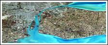
Work with USGS integrated National Map (TNM) data. (2KPG)
The workplan for 2012 (2GKG)
OOR updates (2F0D)
For more information see the minutes of the various 2011 and 12 meetings on the SOCoP forum. (2F0E)
For older information on SOCoP see: http://semanticommunity.wik.is/Spatial_Ontology_Community_of_Practice. (2JNV)
For information on meetings see SocopMeetingpage. This includes links to information on upcoming meetings, agendas and meeting minutes (1ZS2)
Goals :The Spatial Ontology Community of Practice (SOCoP) was established to foster collaboration among researchers, technologists & users of spatial knowledge representations and reasoning towards the development of spatial ontologies for use by all in the Semantic Web and (27HF)
SOCoP supports open collaboration and open standards for increased interoperability of spatial data across government as a collaborative network to help achieve greater levels of geospatial interoperability over that presently available. (27FX)
- see SocopMeetingpage for information on upcoming meetings, agendas and meeting minutes (27G2)
A Brief History of SOCoP on SOCoP/History (2JNS)
Reference Material on SOCoP/Ontology(ies) and ontological engineering See SOCoP/GeospatialOntologies (2JCO)
(2JOZ)
SOCoP Projects (27G6)
SOCoP encourages collaborative efforts. (27HD)
One example concerns the use of USGS data. For more information see NationalMap_data (27G7)
For more information, contact the SOCoP Executive Secretary - Dr. Gary Berg-Cross via email to: gbergcross [at] gmail.com (27CO)

See SOCoP/SOCoP_Wiki_Page_Editing for a 4 page Introduction to editing the SOCoP Wiki (39I3)